IMTUF.com
THE WILD STEELHEAD 105K + 22K
JULY 17, 2027
NEW FOR 2027! A WILD, ONE-WAY MIGRATION FROM RIGGINS TO MCCALL, IDAHO. PACKING 15,000 VERTICAL RISE WITH INDIVIDUAL CLIMBS OF 7000' AND 5000', THIS UNCOMPROMISING LINE IS BEAUTIFUL FROM BEGINNING TO END. SOME DETAILS ARE STILL PENDING BUT EVERYTHING IS LOOKING GOOD FOR A REGISTRATION OPENING OF JANUARY 2ND.




general RACE info
DATE: JULY 17, 2027
START TIMES & LOCATIONS:
*105K will start at 6:00AM MST at Island Bar near Riggins, ID.
*22K (proposed, not confirmed yet) will start at 10:00AM MST
at Clayburn Saddle Trailhead. You finish here, also.
*105K FINISH: Gordon Titus Parking Lot (AKA Goose Creek Falls Trailhead).
COURSE STATS: The 105K is a ONE WAY route, 65+ miles long with approx 15,000+' of climbing and 11,000+' of descending. The 22K is a loop course with an out and back to the summit of Hard Butte and it will be 14 miles long with close to 3,000' of climb and descent. Use the 105K/22K course tabs for more detailed route info, aid station locations, GPX map files, etc.
105K COURSE DETAIL

LOGISTICS:
This is a ONE WAY race. That means logistics are paramount. We are arranging for bussing on race morning from the finish at Titus Lot, down to Island Bar start. We are unsure how many busses we will be able to procure. Each bus holds 50 butts. The race starts at 6AM MST, so that means a very early bus ride. Google MAPS says this is a 46.9 mile/60 minute drive, but a little longer by bus. For runners with a crew vehicle, you can drive to Island Bar and be dropped off for the start. We do not want a mass of cars left behind at Island Bar. Race starts, we clear out and don't come back.
CREWING & PACING & MULING:
Because of the logistics, we strongly recommend that runners lacking 50+ mile finishes should bring a crew. We are not arranging transport back to the finish line if you drop along the way. Pacing & MULING will be allowed and ENCOURAGED from mile 31/50K (Upper Hard Creek Camp/ AKA Bowhunting Camp) to the finish. The race footprint was 1860's Gold Rush country and mules played a big part. Bring a trusty friend along to lighten your load. You will need a vehicle driver and a pacer/mule, so no cars left behind along the race course. Everything and everyone moving south towards McCall.
AID STATIONS:
There are big gaps crossing the mountains with no access, so we have a modest 4 aid stations with 5 more unmanned water stations.
MANDATORY GEAR: TO BE ANNOUNCED.
A small filter flask like this Hydrapak UltraFlask should be carried so that every water you encounter is fair game. You are climbing up from a desert environment to the high alpine. Detailed water availability info will be shared from the start to mile 22, where you are climbing over 7000' in one 16 mile push. Understand that if weather threatens prior to raceday (excessive heat, cold, storms, etc), I reserve the right to make certain pieces of kit or hydration/nutrition mandatory.
COURSE INSPIRATION:
My inspiration for the course stems from October 2012. After our inaugural IMTUF, I was talking with oldschool Riggins
ultra-hardman Jim “Upty” Updegrove. He and his wife Jan had volunteered at an aid station. He told me he thought I did a good job laying out IMTUF, but…“You made ONE BIG MISTAKE. You didn’t take the race down into the Salmon River. Those are the best trails.” Anyone that knows Jim, knows he is a gruff guy and I wasn’t thrilled with his take after being awake for two days of IMTUF-ing. I explained that 100 miles only goes so far and some gems get left out. Over the years, as I explored more and more of Jim’s home turf around the Salmon River breaks, I realized that he was right. The biggest and wildest country was the northern stretches of the Salmon River Mountains. We added Heavens Gate at Rapid River in 2021, but still the one way adventure tying it all together eluded me. Many winters, I would map-study and piece together lines running from Riggins to McCall. It was daunting because some of the best trails needed massive work. This summer of 2026, I did that work with some friends and the king line now goes.
Here’s to Old Jim Upty for lighting the fire!
OUR NAME: THE WILD STEELHEAD?
I've been chasing Steelhead on the Great Lakes since I was still in my momma's belly. Now in Idaho, we have the real deal Pacific Ocean run fish. Ferocious, freight trains that put it all on the line to run several hundred miles up the Columbia, Snake and Salmon Rivers to procreate. We celebrate this run by visiting a few of the Steelhead's spawning grounds: The Big Salmon River and the Little Salmon River's tributaries of Hazard and Hard Creeks. Many Steelhead do not survive the spawn. Some do and will return to the ocean and make the run again. These are the kelts. I predict once you get a taste of The Wild Steelhead, you too will be a kelt and line up again at Island Bar to make your run.
There are some other Easter eggs hidden in the name. Wilder Steel is our first born. My Old Man toiled in the steel mills of Western Pennsylvania and Northeast Ohio for a living. His only wish was for me to be a runner and not have to work in the mills like he did. We honor his sacrifice. Go Steelers!
TURN BY TURN NARRATIVE OF THE ENTIRE 105K COURSE
SECTION 1: THE SALMON RIVER BREAKS TO CLAYBURN TRAILHEAD.
Begin at the aptly named Island Bar at 1750’ elevation. It is so named because sometimes during spring high water, the river claims the access road and the popular spot becomes an island. Climb up the access road, crossing a cattle guard and turn left onto the paved Salmon River Road. This rolling 2.75 miles is some of the finest road running there is. The Big Salmon is huge and flowing angrily over and around giant boulders. The canyon is rimmed by peaks many thousands of feet up. Bighorn sheep play on the rock faces and the wind whistles through the narrow gorge. At mile 2.75, reach the yellow Lake Creek bridge on your left. Don’t cross it. Go right onto the dirt Forest Road #50104. This is private land with a right of way for the public to access the US Forest land above. Pass through a gate and climb for two miles to 2600’ elevation and the end of the road at mile 4.9. We will have a table with water here at the Lake Creek Trailhead.
Singletrack and big climbing characterize the next 11+ miles. The first mile of the trail climbs modestly on Lake Creek Trail #155 to a junction just before a small bridge. Veer left on Trail #153, the Patrick Butte Trail. Begin a series of switchbacks that climb up out of the brushy river bottom environment onto the grassy slopes above. Somewhere around 35-40 switchbacks later, you emerge onto the North Ridge of Patrick Butte at 6000’ elevation and mile 9.5 of the race. From here, the switchbacks end and the trail climbs at a steady, gentler angle up the North Ridge. At mile 12.6/ 7100’, pass the obvious toe of the North Ridge that sweeps up the top of Patrick Butte. If you are here for a training run, hike up there and tag it. On race day, the trail keeps flowing south and you are soon greeted with views of the mammoth East Face of Patrick Butte. You will be thinking about water by now. Thankfully, some beautiful springs flow off that east face and intersect the trail. Between mile 13.25 and 13.75 are a few obvious drink spots and at 13.75 you reach Hell Creek, which is cold and deep enough to submerge yourself if the heat is rising. Do not go past this section without filling your bottles and cooling down. There is more climbing ahead and not much access to good water. This is your chance.
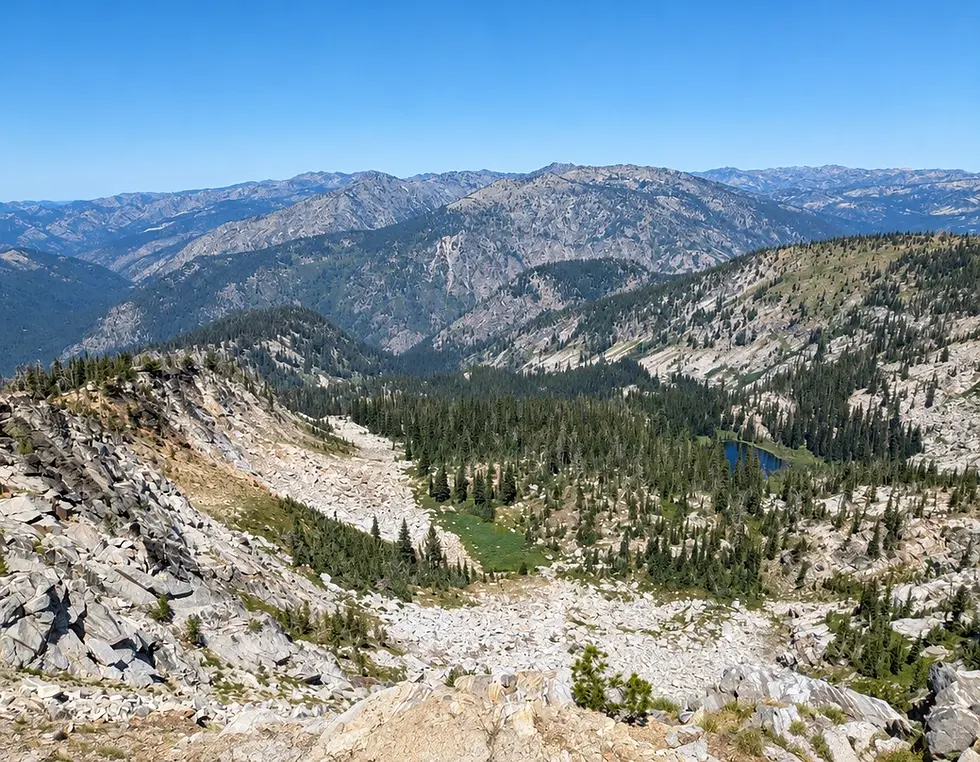
Climb out of the Hell Creek drainage and soon pass a faint junction with Bear Grass Saddle Trail #151 at 7400’. It is so faint I didn’t even recognize it last summer. Stay right on Trail #153 and continue climbing steepening switchbacks to 8000’ as you crest a ridge and glimpse into the Paradise Lake cirque. It is wild and insanely beautiful here. You are a long way from anywhere. Drop a few hundred feet and traverse above the lake without approaching its shoreline. Reach the headwall on the opposite side of the cirque and face one more crux up to 8200’ as you crest a final ridge at mile 16.5 and escape the longest climb of your lives. Take it all in.
The trail rolls south along a divide, descending gently through open country. At mile 17.6, veer left onto Trail #371 and soon after another veer left on Trail#347. Continue descending as you pass Hard Butte on your right and reach Warm Spring Saddle at mile 20.0/ 7300’. The singletrack becomes a smooth double track trail and rolls gently over a sweeping meadow for two more miles to reach Clayburn Saddle Trailhead at mile 22. It is not hyperbole to say that some of you will consider that to be the finest 22 miles you have ever encountered in the mountains. Jaw dropping stuff. Get some good aid, see your crew, and be on your way. Easier miles ahead.
SECTION 2: HAZARD AND HARD CREEK LAKE AREA.
The next 5.0 miles are gently rolling on the well-graded on Forest Road #257. Crew Vehicles will share this road on their journey out to Clayburn Saddle, so watch for traffic. The road drops down to near 6700’, then regains some of it as it passes turnoffs to Big Hazard Lake and other obscure forest roads. Turn LEFT into the Hazard Lake Campground, a very nice US Forest Service Campground. We will have a water station here, at the point where the Trail #169 exits the campground. This is a gorgeous singletrack that accesses Upper Hazard Lake and Upper Hard Creek Lake. Word of caution…there are LOTS of things called Hazard and Hard on this race course. Use precise language and map reading to educate yourself and your crew on the differences.
Climb gently through meadowy terrain, then a bit steeper as you approach and pass Upper Hazard Lake. Then a bit more grinding up to Hard Creek Lake at mile 29.6. In the short stretch, there are two vague junctions on your left with Trail #511. Bypass both and stay on the good trail #169 all the way out the trailhead at the short Forest Road #706. This is a small, dispersed camp area and trailhead. We call this Hard Creek Bowhunting Camp. This will be a crew spot, aid station and your first PACER/MULE access point. There will be a firm cutoff here, TBA. The reason is, you will not see your crew for 23.5 miles from this point. You are heading down into the Little Salmon River drainage, a massive drop and climb back out. DROP HERE if there is any question in your ability to pull off the next 23.5 miles with over 6000’ of climb and nearly 7000’ of descent.
SECTION 3: GRASS MOUNTAINS AND THE MORGAN LAKE TRAIL.
From the aid station at the trailhead, run down the short access Road #706 to the main Goose Lake Road #257. This is tricky. GO RIGHT AND IMMEDIATELY LEFT onto the unsigned TRAIL #163. This shortcut trail is not widely used and often needs a little work. It eliminates the need to run down the road #257 to get to the Grass Mountain Trail. The shortcut trail joins the more obvious Trail #163 after about a half mile at a somewhat confusing 4 way junction. A big downed tree laying here has further confused this junction. We will clean it up and it will be obvious on raceday. You want to take Trail #163 uphill to the Grass Mountain Lakes area. Climb on a few hundred more feet to a big meadow with a junction. Stay RIGHT at the junction to avoid the Grass Mountain Lake shoreline. Keep RIGHT and traverse above the lakes. You will look down on the lakes to your left as you ascend. Climb up to 7900’ at an obvious saddle on the ridge. This is mile 33.7. At mile 34.1, pass the signed junction to Coffee Cup Lake on your right but stay on the main Trail #163. A few short but sharp climbs along the ridge bring you to a final knob at the precipice of the canyon at mile 35.3.
Nothing but down for a while. The trail is pleasant at first, but at 7500’ it drops on the fall line of the ridge through a tremendous erosion trench for about 700’ of gnarly descent. I call this the Gutter. This ends around 6800’ as the trail becomes a doubletrack at the turnoff for Morgan Lake Trail #372 on your right. Stay on the much wider and smoother Trail #163 and continue your descent through many gradual switchbacks. The tread moves through big pine forest, old burnt areas and eventually into the grassy and brushy lower altitudes of the canyon. Trail #163 ends at 3600’ elevation at a small trailhead for Trail #163 and Lower Hard Creek Trail #549, which is sometimes shown as Trail #164 on old maps. We will have the Morgan Lake Trailhead Aid Station, mile 42.5 here at this small trailhead. No crew permitted.
SECTION 4: LOWER HARD CREEK TO GRANITE MOUNTAIN.
From the Morgan Lake Trailhead, go left on the doubletrack Trail #549 that runs along lower Hard Creek. Make use of the many small water crossings to splash off with cold water. It is hot below 4000’ in mid-July so take care to keep cool. At mile 45.0, the double track ends at a big campsite. Move RIGHT and cross Bascom Creek. The trail resumes on the other side of the creek as a singletrack Trail #164 and heads LEFT and continues up the Hard Creek canyon. At 4000’ elevation, the trail exits a meadowy section and begins tight switchbacks up through rock bands. The trail is brushy and obscure through here, but we will improve it for race day. At 4700’, reach a small saddle and drop to 4400’ at a crossing of Hard Creek. You will get wet here. Knee to thigh deep water in July.
Ford the creek and begin switchbacking up the Browns Creek drainage. After a short climb, you will hear a rumble of raging water on your right. If you choose, you can take a short side quest (about 40 steps off route) to Browns Creek Falls. There is a vague trail to the right that takes you there and back. Get back on the main trail and continue up the switchbacks. At 5250’ elevation/ mile 47.9, reach the deadend of Browns Creek Road #294. We will have an unmanned water station here. Run along Browns Creek Road for 1.2 miles of easy rolling. At mile 49.1/5350’ elevation, reach a dual trailhead for Bally Mountain on the right/west side of the road and Granite Mountain on the left/east side of the road. We are climbing Granite Mountain, so you turn LEFT and climb. This is the final showstopper crux of the Wild Steelhead, so bear down and grind it out. 3000+’ of ascent in just under 3 miles. Let’s break it down into thirds.
The first thousand feet is excellent tread through a beautiful pine forest. Shaded and nice. An intricate chainsaw-carved wood mushroom on the trail marks the end of this section. The next third is predominantly open grassy meadows that climb steeply through sparse trail. We have done lots of work here to improve the tread and revive this lost gem, but you can still count on grassy and sage covered footing with sparse tread. It will be marked very well. Some runners will be facing darkness here, so lots of reflective markers will guide the way upward. The final third begins around 7600’ elevation as you gain the ridge and begin a long, sweeping traverse to the right on better tread through rocky terrain. At the final summit push, some steep switchbacks bring you to the uber-classic Granite Mountain Fire Lookout at 8471’ and mile 52.0 of the race. Mind-blowing 360 degree views from here. Hopefully, we can get the Lookout Caretaker (she is super cool and her name was Hannah in 2026, not sure she will be the Caretaker for 2027) involved in the race as a morale booster and maybe even a treat hander-outer. I will advise on all this once the staffing picture becomes clear for 2027. There is still work to be done, but the final crux is behind you now. Ahead is 13+ miles, mostly down with less than 1,000’ of climb remaining. Let’s go!
The descent off of Granite uses the popular, but rugged East Ridge route. It is a 2.8 mile descent with about 1900’ of drop. It is not a gimme. It passes through a rough rock band from 8200’ down to 7700’ and moderates after that but stays technical to the bottom. With blown out legs, you may be reduced to a pathetic limp. Carry on. Your crew and easier terrain awaits at the Granite Trailhead (AKA Twin Lakes Trailhead), mile 54.7.
SECTION 5: GOOSE CHASE
Lots of Goose-named terrain over this final 11 miles. Lock in and get ‘er done. Leave the Granite aid station and head south on an obscure cattle trail dropping down through a drainage, parallel and just east of Goose Lake Road #257. This trail is unnamed and mostly unknown and covers exactly 1 mile to the shore of Goose Lake at 6400’ elevation. There are two crossings of the main flow of Goose Creek in this section. If either is too deep or fast, we will use the main Forest Road #257 to get down to the same spot. No biggie. Either way is fine.
Now run along the shore of Goose Lake on Road #257. If the water is low enough, we may use a cattle trail that runs through the lake bed. Go RIGHT onto an old forest road (sometimes shown as Old Goose Lake Road). This runs a half mile and becomes the dam and causeway for Goose Lake. Cross the dam and reach Grouse Campground Day Use Area. This will be a water station and crew access point. Continue on the road that exits Grouse Campground onto Road #50273. Go LEFT and soon after reach the main Goose Lake Road #257 and go RIGHT. Cover 3.3 miles on Goose Lake Road with just a few hundred feet of climbing and descent.
Reach Brundage Reservoir Dam at mile 61.3/6200’ elevation. This will be a water station and crew spot. Go RIGHT onto Goose Creek Falls Trail #353 and descend. After 1.5 miles, cross a tiny, single log bridge over Goose Creek. Continue dropping to 5200’ where you turn LEFT and cross a big bridge over Goose Creek on Trail #354. This is the sting in the tail. You are 1.2 miles from the finish with 500+’ of climb, mostly in the final half mile. Power up the slope, crest the ridge and you are a few
hundred downhill yards from the finish. That's a big day in the hills.
22K COURSE
We are still working on our "short" race to go along with the 105K. Right now, we are leaning towards a 22K/14 Miler that starts and finishes at Clayburn Saddle Trailhead, which is mile 22 and an aid station for the 105K. The proposed route is to loop around Lava Butte and return back to Clayburn for an aid station visit, then summit Hard Butte and return to Clayburn for the
finish. This would feature climbs to two ultra classic high points and pack just under 3,000' of climbing and descent.
POLICIES
Refund Policy
1. We will refund 50% of your entry fee until April 1st at 11:59pm.
2. After April 1st, there will be no refunds.
3. We will not do any rollover or transfer of bibs.
4. This is a mountain race. If the race must be cancelled due to fire, severe weather, pandemic, etc, there is no possible way for us to refund or rollover your entry. That money is gone. When you register, consider this issue and either commit or stick to safer races that run in circles.
5. If facing personal financial hardship, reach out to us.
Dogs
Dogs are not permitted to run the race with our runners. This is a safety issue and our permit and insurance mandates our compliance. Dogs attract other wild animals and the leashes tangle and cause tripping issues. Leashed and well behaved dogs can enjoy the finish area.